
Walking
The picture at the top of the page shows a view of Winchester Cathedral from Hurdle Way (taken with a long lens).
This is a wonderful part of the country for walks.
There is a keen walkers’ group in the parish.
Reports of some of their past walks and dates of planned for future walks are under walkers. Walks usually start by meeting at the Jubilee Pavilion.
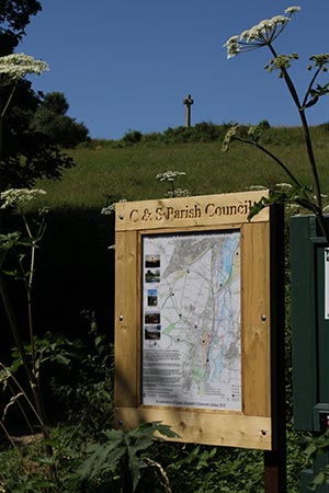
Former Parish Councillor Tom Threlfall documented an interesting historical Serendipity Trail around the parish.
External links
Here are a few links which you may find useful.
Because they are external websites, we cannot guarantee that the links will always be uptodate or that the information will be current and correct.
- Winchester walks
- Walk4Life – search for walks in any area. You now have to take out a subscription (£5 a year) before you can download details of walks such as the Valley of Fields circular walk, which is mostly in our parish and also takes in St Cross.
- Walking in Hampshire
- Hampshire and Isle of Wight Wildlife Trust walks – this link takes you to the Hockley Meadows Nature Reserve.
- HCC Walking in Hampshire covering Long distance routes, Shorter walks, Guided walks, Dog walking, Maps, Rights of Way and more
- The RSPB Winchester Local Group organises walks which are open to all and free.
- Find local walks by entering your postcode at Walking for Health
- Edible and Medicinal Plant Walks
- Visorando’s Free online Walking Route Planner which allows you to draw a track on an Ordnance Survey walking map. You can then print, export or share it with other walkers.
Definitive Footpath Maps
Hampshire County Council maintains the official map of footpaths and rights of way.
Here are some links to pages on the HCC website
- The Definitive Map of public rights of way in Hampshire
- The definitive descriptions of footpaths within our parish (and in other parishes in Hampshire whose names begin with ‘C’)
- PDF format index of footpath maps within the county
- Map tiles covering Compton & Shawford: Map numbers 11:13 12:13 12:12 11:12
Why not try the County Council’s new online mapping tool?
Just visit http://www3.hants.gov.uk/row/row-maps.htm and click on the link to online maps.
You can zoom in on an area in Hampshire where you are planning to walk and see the rights of way.
This is a beta service so is not guaranteed to continue, and if it does, there may be changes in the final version.
You can also download a KML file which you can overlay on other mapping tools, such as Google Maps (with apologies to those for whom this may be too technical).
- Have you discovered our scrollable zoomable Local Rights of Way page?
- And our list of Rights of Way in Compton and Shawford?