
Maps
In this section


Compton & Shawford Defibrillators
Defibrillators in the Compton & Shawford - listed and marked on the map
Parish Boundary
Map of the parish boundary. Choose between displaying any or all of the boundaries of the civil parish,...
Protected Areas - MAGiC (external site)
MAGiC (Multi-Agency Geographic Information for the Countryside): a public government interactive map...
Schematic map
Schematic map of the parish showing roads and major features

Local Rights of Way Map
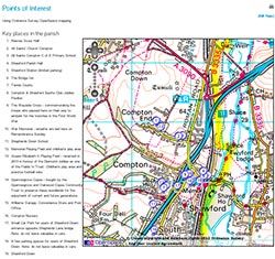
Rights of way in and around Compton & Shawford using Ordnance Survey mapping, provided by
Parish Rights of Way
Hampshire County Council owns the description of all the Rights of Way in the county.
On the HCC website,...
Parish Paths Map
Public Rights of Way, permissive paths and unclassified paths in and near Compton and Shawford
Ordnance Survey mapping
Experimental interactive map using the Ordnance Survey OpenSpace tools. Possible uses include showing...
Planning Applications Map
A map showing the 30 most recent planning applications in the parish.
OpenStreetMap of Compton & Shawford
The map on this page comes from the OpenStreetMap project (OSM).
What's the advantage of OpenStreetMap?...