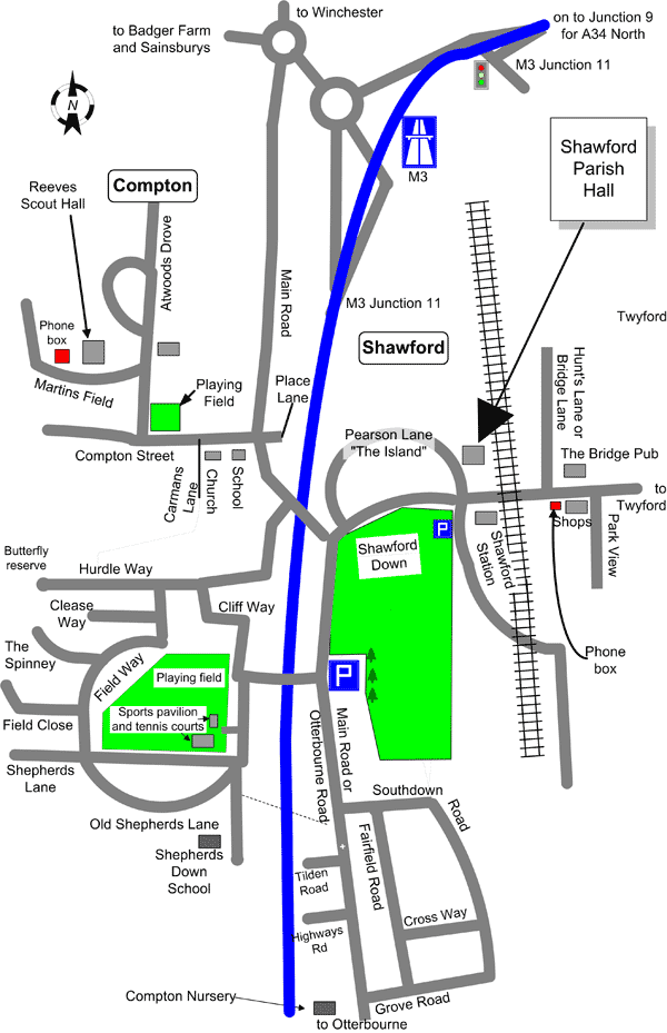
Schematic map
(not to scale)
A word about place names
Newcomers to our village – and even old inhabitants – are sometimes confused by street names here. If you are expecting visitors you may need to explain some of this to them to avoid their being confused by signposts.
The Compton part of Compton and Shawford includes all the area to the west of the motorway and those properties to the west of a line down the middle of Otterbourne Road, also known as Main Road.
The remainder of the village, as far as official postal addresses are concerned, lies in Shawford. However, the people living in the area at the top of the down, bounded by Southdown Road and Grove Road tend to refer to their district as Southdown and the area is signed Southdown. The Shawford signs direct you to Shawford village, the small area centred on the Station, the Village Hall and the Bridge pub.
Several streets in our village are known by more than one name. The main road through the village is variously known as Main Road, Otterbourne Road, Winchester Road; and also sometimes Roman Road and even Bournemouth Road.
The road in Shawford known as The Island is now officially called Pearson Road.
The road in Shawford between the railway line and the pub is known as Hunts Lane, Bridge Lane, or Station Alley but is now officially Bridge Lane.

